Geography: The Canada / United States Border
This is our fifth study session (April 15, 2021), which was at Grand Dad’s. Note, all links open a new tab in your browser.
Review
- Tell me about New York State.
- What is the capital city? And the biggest city?
This is the start of the new lesson.
The Canada/U.S. Border (continuing on)
As we noted, a big part of it runs along the 49th parallel. We also noted that the citizens and residents of Canada and the U.S. have very different laws, taxes, and expectations from their governments.
Let’s continue to get good at visualizing the border between the two countries. It’s length, shape, and which provinces and states face each other across the border.
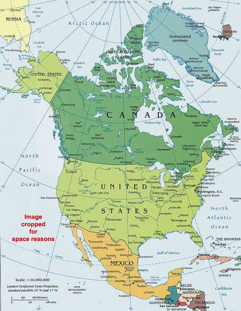
The Canada / United States border runs from the Atlantic Ocean west all the way to the Pacific Ocean. So our border runs across the entire continent.
It is the longest international border in the world between two countries. It runs 8,891 kilometers (5,525 mi) long. The border has two parts: Canada’s border with the contiguous U.S. to its south, and Canada’s border with the U.S. state of Alaska in the Northwest.
1. Let’s draw the border and add as many details as possible. Get out a white sheet of paper, or notebook.
2. BORDER PROVINCES:
Last time we looked at the Eastern provinces. Note, Quebec and New Brunswick DO border the U.S. Newfoundland, PEI, and Nova Scotia do not border the U.S. Let’s look closer at Ontario and Manitoba today.
3. BORDER STATES:
We started looking at some of the states that border Canada directly. Let’s start by taking a closer look at Maine. Next week, let’s look at New Hampshire and Vermont.
Let’s keep spend time getting to know those provinces and states!