Geography: The United States of America
This is our second study session (March 10, 2021). Session at Grand Dad’s home. Note, all links open a new tab in your browser.
Review
- Tell me about Latitude and Longitude. Please define them.
- Can you remember at least one of the online maps?
- Name two states in the United States. Where are they located?
- What river did we talk about last time? Tell me about it.
a.) The United States

The U.S. (or U.S.A., or America) is the most powerful country in the world from from the standpoint of political, economic, and cultural impact. You can click on each bold word to see its definition. Remember, the 49th Parallel is the main boundary between Canada and the U.S. Some facts:
- 50 states (48 states plus Alaska and Hawaii, which are not attached).
- The fourth largest country in the world in area (after Russia, Canada, and China).
- Its exports and imports are a major proportion of the world total. This is part of its “economic” impact.
- Let’s look at facts and maps in the Britannica article to learn more …
b.) Looking at two states. New York, Illinois.

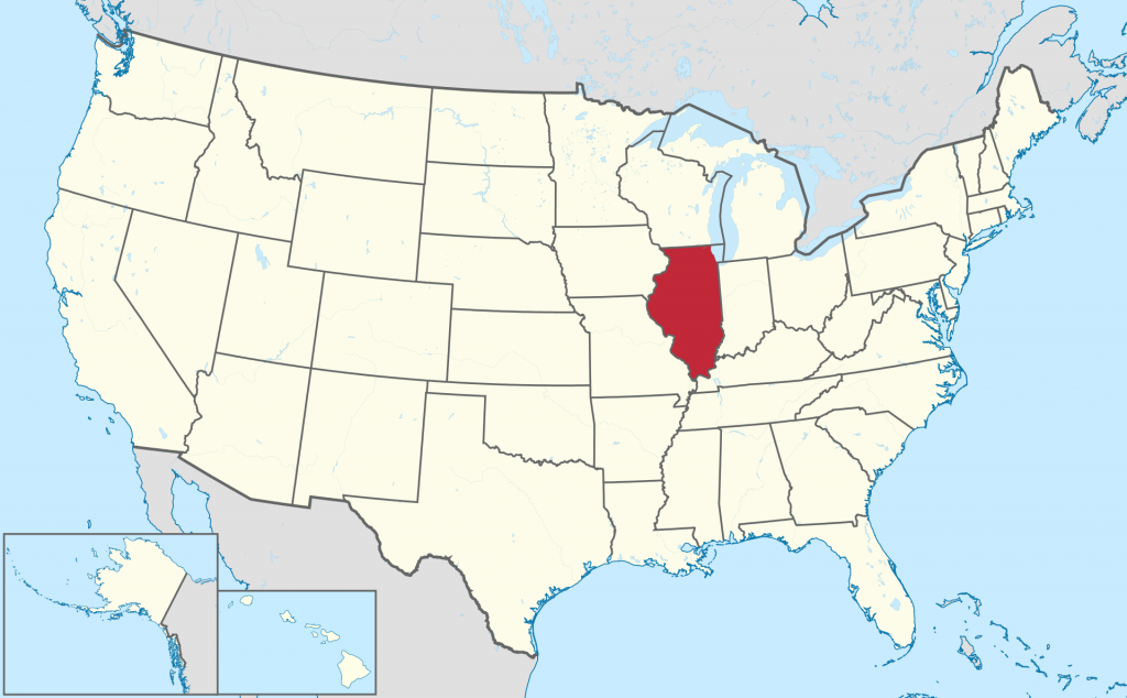
Let’s take a look at two states. New York and Illinois. The U.S. is the country. The country is composed of states. The states are made up of towns/cities, and country areas. These are three levels of how the areas are administered (taken care of). Big, medium sized, and small. Country/state/municipal.
New York (video)
Illinois (video 1) | Illinois (video 2)
Chicago, Illinois (video)
Cheat Sheet for Review of Lesson 1
LATITUDE & LONGITUDE
Latitude: lines that determine a location east or west. They run north and south from the earth’s equator measured from zero to 90 degrees. Longitude: lines that determine a location north or south. They run east west across the earth’s surface, starting at Greenwich, England, and are also expressed in degrees from zero to 90. Geography Realm link.
ONLINE MAPS
Here are two maps we looked at last time:
| Open Street Map | An Open Source map that is built by many volunteers. Map and directions. |
| WeGo Here | Was funded by BMW and other car makers. Map and directions. |
| World Atlas map | Map of U.S physical characteristics; Rocky Mountains, Central Plains, etc. |
| On The World map | Shows U.S. states and capitals. |
| Nations Online map | Good introduction to the U.S. (see “About the United States”), and then click on the map to enlarge. Shows many details. |
Mississippi River
One of the main physical features of the United States: the Mississippi River. At 2,340 km’s, it is the longest river in North America. If you add in the Missouri River system, it is 5,971 km long, taking that route. Britannica article. World Atlas article. Map.
Comments
2 responses to “Lesson 2”
I reviewed for around 15 minutes or so. I really liked naming the states of the us, I also liked the Mississippi River as well
Thank you, Ania. I’m so glad you reviewed, and that you liked naming the states. And that you like the Mississippi.