Geography (and a bit of history): Field Trip
This is our seventh study session (Thur. June 10, 2021), taking a field trip to Niagara
This is our seventh study session (Thur. June 10, 2021), taking a field trip to Niagara
This is our sixth study session (Wed. May 26, 2021), at Grand Dad’s. Note, all links open a new tab in your browser.
Both of you, please create a pop quiz for your sibling. Please follow these steps:
This is our fifth study session (April 15, 2021), which was at Grand Dad’s. Note, all links open a new tab in your browser.
As we noted, a big part of it runs along the 49th parallel. We also noted that the citizens and residents of Canada and the U.S. have very different laws, taxes, and expectations from their governments.
Let’s continue to get good at visualizing the border between the two countries. It’s length, shape, and which provinces and states face each other across the border.
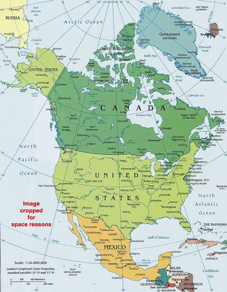
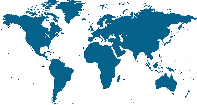
The Canada / United States border runs from the Atlantic Ocean west all the way to the Pacific Ocean. So our border runs across the entire continent.
It is the longest international border in the world between two countries. It runs 8,891 kilometers (5,525 mi) long. The border has two parts: Canada’s border with the contiguous U.S. to its south, and Canada’s border with the U.S. state of Alaska in the Northwest.
1. Let’s draw the border and add as many details as possible. Get out a white sheet of paper, or notebook.
2. BORDER PROVINCES:
Last time we looked at the Eastern provinces. Note, Quebec and New Brunswick DO border the U.S. Newfoundland, PEI, and Nova Scotia do not border the U.S. Let’s look closer at Ontario and Manitoba today.
3. BORDER STATES:
We started looking at some of the states that border Canada directly. Let’s start by taking a closer look at Maine. Next week, let’s look at New Hampshire and Vermont.
Let’s keep spend time getting to know those provinces and states!
This is our fourth study session (March 31, 2021). Session at our home, and then Easter egg painting. Note, all links open a new tab in your browser.
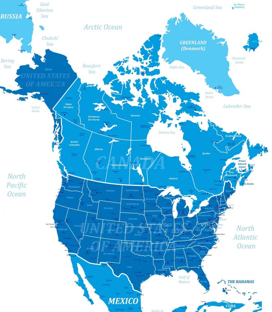
A border is a line that divides two countries. A person or goods usually have to pass through “immigration” and “customs” checks before they are allowed across. The citizens and residents of Canada and the U.S. have very different laws, taxes, and expectations from their governments.
Let’s begin to get good at visualizing the border between the two countries. It’s length, shape, and which provinces and states face each other across the border.
THE Canada / United States border runs from the Atlantic Ocean west all the way to the Pacific Ocean. So our border runs across the entire continent.
It is the longest international border in the world between two countries. It runs 8,891 kilometers (5,525 mi) long. The border has two parts: Canada’s border with the contiguous U.S. to its south, and Canada’s border with the U.S. state of Alaska in the Northwest.
1. BORDER PROVINCES:
Please identify the provinces that do and don’t border the U.S. directly. Please write them down and send to me.
2. BORDER STATES:
Please identify the states that border Canada directly. Please write them down and send to me.
Let’s spend the next few weeks getting to know those provinces and states!

This is our third study session (March 17, 2021). Session at your home. Note, all links open a new tab in your browser.
This is our second study session (March 10, 2021). Session at Grand Dad’s home. Note, all links open a new tab in your browser.
The U.S. (or U.S.A., or America) is the most powerful country in the world from from the standpoint of political, economic, and cultural impact. You can click on each bold word to see its definition. Remember, the 49th Parallel is the main boundary between Canada and the U.S. Some facts:

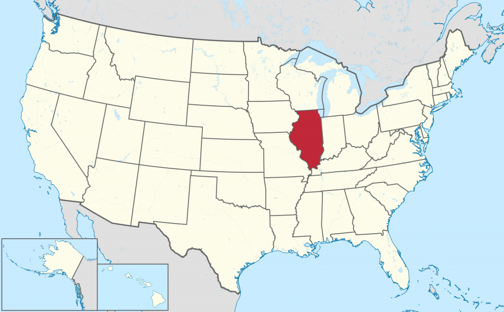
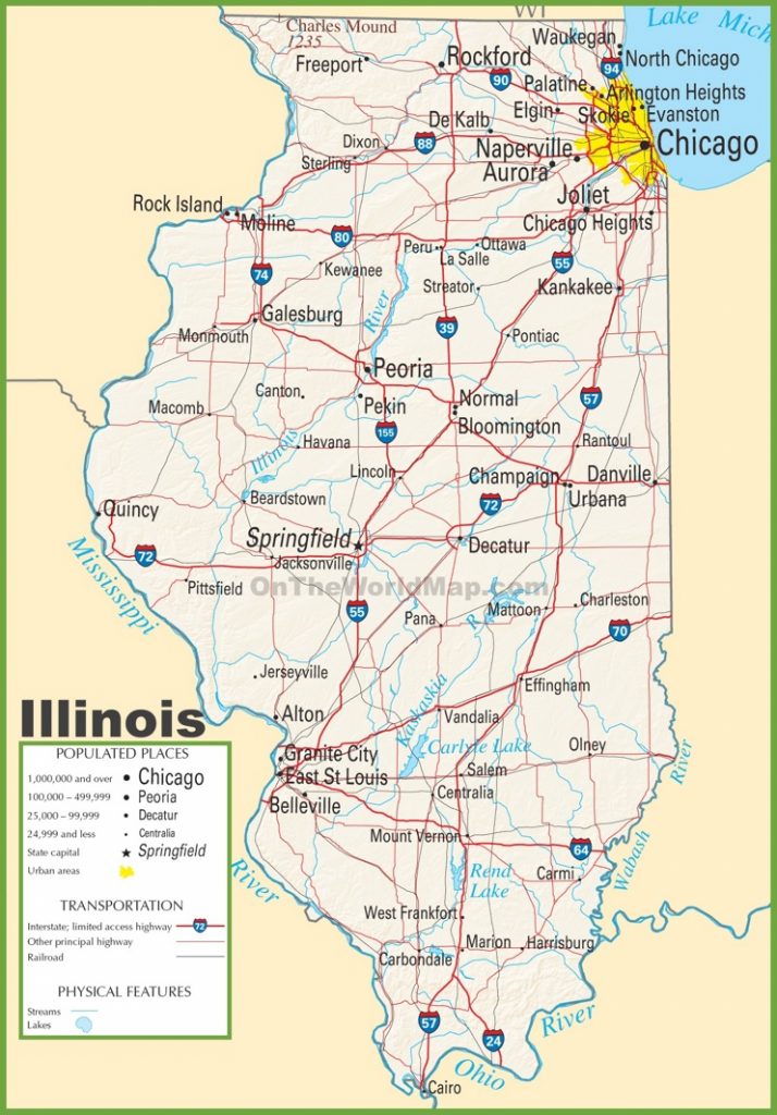
Let’s take a look at two states. New York and Illinois. The U.S. is the country. The country is composed of states. The states are made up of towns/cities, and country areas. These are three levels of how the areas are administered (taken care of). Big, medium sized, and small. Country/state/municipal.
| Open Street Map | An Open Source map that is built by many volunteers. Map and directions. |
| WeGo Here | Was funded by BMW and other car makers. Map and directions. |
| World Atlas map | Map of U.S physical characteristics; Rocky Mountains, Central Plains, etc. |
| On The World map | Shows U.S. states and capitals. |
| Nations Online map | Good introduction to the U.S. (see “About the United States”), and then click on the map to enlarge. Shows many details. |
One of the main physical features of the United States: the Mississippi River. At 2,340 km’s, it is the longest river in North America. If you add in the Missouri River system, it is 5,971 km long, taking that route. Britannica article. World Atlas article. Map.
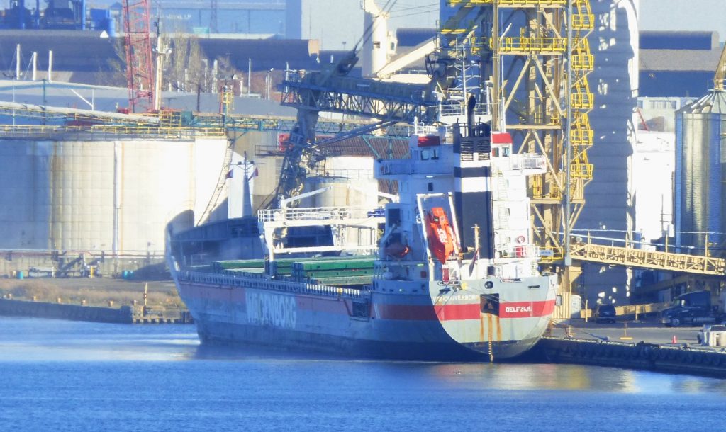
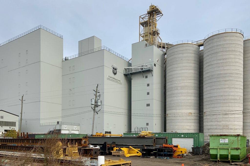
Notes: Owner: Royal Wagenborg. Built in 2001. My sighting was of Vancouverborg taking on grain at P&H Milling Group in Hamilton Harbour. I couldn’t get a good shot no matter what I tried because it was in a secure area. The two best angles I got was from high ground across the harbour with my telephoto, and another shot of the back of the ship outside the secure area. The ship then set off at night, and anchored the next day in Lake Ontario near Port Weller. She then sailed to NEWPORT UK, AUGHINISH Ireland, and three other ports in Europe, before returning to North America.
Photos © copyright Paul Singer 2020. If you want to use a photo, send me a comment below with your email address. I am open to granting permissions if it is for non-commercial use.
This was our first study session (March 3, 2021). Session was at your house. Note, all links open a new tab in your browser.
Since the earth is a ball, map makers have to find a way to flatten out the representation of earth’s features on a flat surface. None of them are perfect. Here’s more on that.


| Open Street Map | An Open Source map that is built by many volunteers. Map and directions. |
| WeGo Here | Was funded by BMW and other car makers. Map and directions. |
| Seterra | Has a neat map quiz game. |
| Zoom.earth | A cool interactive map that shows satellite views. You can set layers to show various things like cloud cover, etc. |
Britannica article. We looked at the following maps to get a quick overview of the United States from a geographical (physical features) and political perspective (borders and states). We noted the 49th Parallel to be the boundary between Canada and the U.S. for the western part of North America.
| World Atlas map | Map of U.S physical characteristics; Rocky Mountains, Central Plains, etc. |
| On The World map | Shows U.S. states and capitals. |
| Nations Online map | Good introduction to the U.S. (see “About the United States”), and then click on the map to enlarge. Shows many details. |
We decided to zero in on one of the main physical features of the United States: the mighty Mississippi River. At 2,340 km’s, it is the longest river in North America. If you add in the Missouri River system, it is 5,971 km long, taking that route. Britannica article. World Atlas article. Map.

Bonus section: An excellent alternative to Wikipedia for information is Britannica. Enjoy!

Genre: Sci-Fi
IMDB Rating: 8.3
Clean Rating: 3? or 2?
Saw It On: Disney+
My Comments: A 9 episode mini-series with MCU characters Wanda Maximoff / Scarlet Witch and Vision in quite the twist for Marvel/Disney. This is a creative and entertaining TV series with a lot of things that make it endearing. However, since it does deal with a witch who performs massive feats of magic, I cannot recommend this series to families that aim to respect biblical values. ENJOYMENT RATING: I give it 3.5 stars.
External Review: coming…
link to external review coming shortly

SHIP TYPE: Cargo
TONS: 9,719
LENGTH: 138 m
DATE: 11/05/2020
LOCATION: Port Weller, Welland Canal
DESTINATION: Cabedelo (Brazil)
PORTS: Late 2020… CABEDELO (Brazil), RIO DE JANEIRO (Brazil), DAMMAM (Saudi Arabia), Early 2021… KEMAMAN (Malasia), LAEM CHABANG (Thailand). Other Ports... Umm Qasr (Iraq), Mundra (India), Toledo, Port Weller, Montreal
OWNER: NORDANA LINE – RUNGSTED KYST, DENMARK

